Greece’s National Meteorological Service EMY issued a WEATHER RED ALERT on Sunday warning of very heavy rainfalls and storms in the following days. Highest category “Red Alert” is issued to warn of dangerous and extreme weather phenomena.
The weather is forecast to deteriorate from Monday, September 4, to Wednesday September 6, 2023.
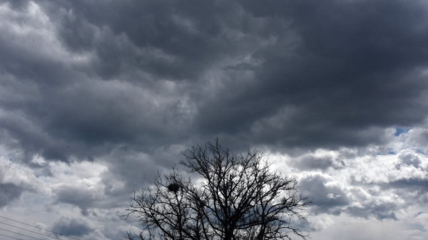
Forecast are heavy rainfalls and storms that will be accompanied by hail and a high frequency of lightning, with increased winds and a noticeable drop in temperature.
Ενημερωθείτε με τα αναλυτικά προγνωστικά δεδομένα ανά 6 ώρες από την @EMY_HNMS pic.twitter.com/UYlfC9aKpV
— Theodoros Kolydas (@KolydasT) September 3, 2023
A barometric low coming from the northern Balkans with cold air masses is forecast to move south, to southern Ionian Sea and affect most areas in the country.
Thessaly, Sporades, central and eastern Sterea, northern Evia and the Peloponnese will receive the highest amounts of rain, EMY stressed.
EMY WARNING
A. Heavy rains and storms
Monday, Sept 4
a. From the midday hours in western and central Macedonia and early in eastern Macedonia and Thrace. From late afternoon the phenomena will be limited to central Macedonia, mainly in the prefectures of Pieria and Imathia.
b. from noon in Epirus, Thessaly, Sporades and gradually in the Ionian Islands, Sterea and Evia
c. from early afternoon in the Peloponnese,mainly the west and the north.


Tuesday, Sept 5
a. at times until the afternoon in Epirus, the Ionian Islands, western Sterea and western Peloponnese
b. in central Macedonia (mainly in the prefectures of Pieria, Imathia and Halkidiki), Thessaly, the Sporades, central and eastern Sterea (mainly in the prefectures of Evrytania, Fthiotida and Boeotia and temporarily in the prefecture of Attica, mainly in its western and northern parts), the Evia (mainly the north), eastern and southern Peloponnese and western Crete
c. from midday to evening in the western Cyclades and the islands of the northern and eastern Aegean.

Wednesday, Sept 6
In Thessaly, the Sporades, central and eastern Sterea (mainly the prefectures of Evrytania, Fthiotida and Boeotia), northern Evia, eastern and southern Peloponnese and western and southern Crete.


From the evening the weather phenomena will weaken except for the regions of Thessaly and the Sporades where they will continue until the morning hours of Thursday.

Winds
B. Strengthened north-eastern winds of intensity 7 to 8 Beaufort will blow in the northern Aegean from the evening of Monday 4-9-2023 until the evening of Tuesday 5-9-2023.
Temperature Drop
C. From Monday 4-9-2023 the temperature will drop noticeably from north to south by 6 to 8 degrees Celsius in the Ionian and continental regions.
EVROS FIRES
Now the whole country is awaiting rainfalls also in the region of Evros, North-East Greece, where the wildfires keep raging for 16th consecutive day(on Sunday, Sept 3)
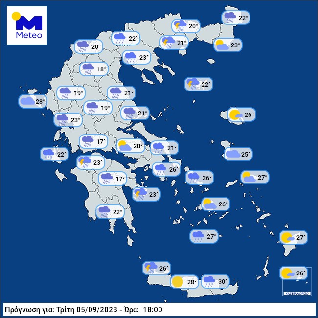
Τα τελευταία προγνωστικά στοιχεία του Εθνικού Αστεροσκοπείου Αθηνών/meteo.gr δείχνουν ότι η χώρα μας θα είναι πιο βροχερή περιοχής της Ευρώπης την πρώτη εβδομάδα του Σεπτεμβρίου.
Αξιόλογες βροχοπτώσεις προβλέπονται και στον Έβρο την Τρίτη 5/9. pic.twitter.com/DUh6mQ7l9c— meteo.gr – Ο καιρός (@meteogr) September 3, 2023
sources: emy, indicative maps meteo.gr