
Greece’s National Meteorological Service EMY issued an emergency bulletin on Friday warning of a cold weather front with snowfalls and rainfalls, gale-force winds both in the Ionian and the Aegean Seas, storms and significant temperature drop.
According to EMY, a deep barometric low coming from the north-northwest accompanied by a cold front is forecast to cause a weather deterioration over the weekend with gale-force winds across almost the entire country, locally heavy rainfalls and storms mainly in the west, north and the eastern islands Greece.
Strong winds video by EMY director Thodoris Kolydas:
🍃Μπορεί οι άνεμοι να μη φτάνουν τις εντάσεις της προηγούμενης εβδομάδος , ωστόσο και πάλι χρειάζεται προσοχή αρχικά στους νοτιάδες στο Ανατολικό Αιγαίο που πρόσκαιρα θα φτάσουν τα 8-9 μποφόρ και στους ΒΔ ανέμους την Κυριακή σε Ιόνιο Θερμαικό και Κορινθιακό @GSCP_GR @EMY_HNMS pic.twitter.com/STCh90t5qX
— Theodoros Kolydas (@KolydasT) November 24, 2023
Snowfall will occur in the continental highlands as well as in semi-mountainous areas of Thrace and Macedonia.
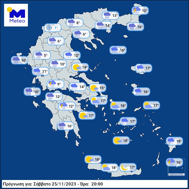
Temperature decrease will be felt from Saturday night and especially on Sunday, November 25-26, 2023. Temperature is forecast to drop by 8 to 10 degrees Celsius in the Ionian and continental areas and by 4 to 6 degrees Celsius in the rest of the country.
EMY WEATHER WARNING
A. Gusty winds will blow from Saturday afternoon, Nov 25, through Sunday evening, Nov 26.
Affected areas:
a. in the west, from the afternoon hours there will initially be west-southwest winds of intensity 7 to 8 Beaufort, turning in the evening to northwest winds with the same intensity.
b. in the east from the evening hours south-western winds blowing with intensity 7 to 8 B. Temporarily in the eastern Aegean Sea with up to 9 Beaufort gradually turning to north-western winds with the same intensity.
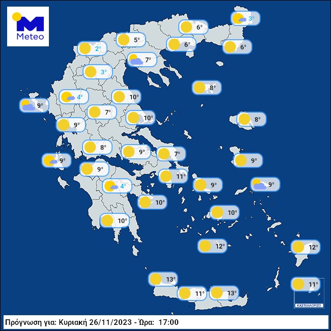
c. A weakening of the winds is predicted from the afternoon hours of Sunday (26-11-23) in the west and at night and in the east.
B. Heavy rains and storms are forecast
a. from the early hours of Saturday (25-11-23) in Ionian Sea Epirus, western Sterea, western Peloponnese and the Dodecanese and from the morning in the eastern Aegean islands and Thrace.
b. from noon in Macedonia and temporarily in the southern Peloponnese, the western parts of Crete and western Thessaly.
c. The strong phenomena on Saturday night will be limited to eastern Macedonia, Thrace and the eastern island of Greece, while in the rest of the country they will weaken.
C. Snowfalls will occur from the evening hours of Saturday (25-11-23) until the midday hours of Sunday (26-11-23) in the continental mountains, but also in semi-mountainous areas of Thrace and Macedonia with an indicative altitude of 500 -700 meters.
EMY Forecasts will be updated every twelve hours.
NOTE: Powerful winds often affect sea traffic. check with local port authorities and travel agents!
Indicative forecast maps: November 25-25, 2023


sources: EMY, meteomaps.gr